Here's a Florida Everglades Map showing you the three main entrances to the park, as well as the four main areas of interest to visitors:
 The Main Park Entrance and Ernest Coe Visitor Center
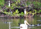
 The Flamingo Visitor Center and Area
 The Shark Valley Entrance and Visitor Center
 The Gulf Coast Entrance and Visitor Center
View Florida Everglades - Attractions and Highlights in a larger map
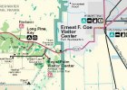
Main Park Entrance Area Map

This is where you will find:
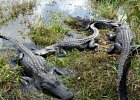
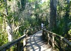
- The Ernest C. Coe Visitor Center
- The Royal Palm Visitor Center
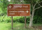
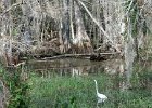
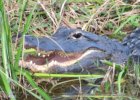
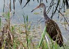
- The Anhinga Trail
- The Gumbo Limbo Trail
- Big Pine Key Camping Grounds
- Biking
Here's more on the Main Park Entrance and Royal Palm areas
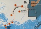
Everglades at Flamingo Area Map

This is where you will find:
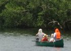
- The Flamingo marina
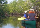
- Boat, House boat, Canoe and Kayak rentals
- Boat Tours into the Florida Bay and the mangrove swamps
- Biking and bike rentals
- Fishing
- Restaurant and Convenience Store
- Campground
- This is where the Wilderness Waterway ends
Here's more on the Flamingo area, facilities, tours and attractions.
Shark Valley Everglades Area Map

Here you find:
- The 15-mile Loop Road
- Tram Tours
- Biking and Bike Rentals
- Lookout Tower
- Bobcat Boardwalk Trail
Here's more on Shark Valley Everglades highlights.
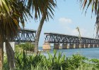
Everglades Gulf Coast Area Map

Highlights of this area are:
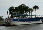
- The Gulf Coast Marina
- 10,000 Islands Boat Tours
- Mangrove Wilderness Boat Tours
- Single and Tandem Kayak Rentals
- Canoe Rentals
Here's more on the Gulf Coast Everglades Area.
The Florida Everglades


Most Popular Everglades Excursions
Book with confidence! Free cancellation: Cancel up to 24 hours in advance to receive a full refund
Our State and National Parks


Miami Events By Month
Coming Up
Most Popular


One Low Price - 25+ Attractions!


Send a Tip!
Got something to share? Let us know!